Team WalkEase present WalkEase!
Over 50% of people are dog lovers. This app is designed to help busy dog owners connect with people who wish to walk dogs but may not have their own.
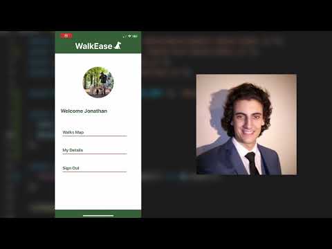
WalkEase, dog walking made easier. Did you know over 50% of people are dog lovers yet only 33% of UK households own dogs, many of these dog owners don’t always have time to walk their pets on the other hand lots people love spending time with dogs but don’t own their own and so we offer a solution. 'Owner' users will be able to add dogs to their account, where they can then list them to be walked. 'Walker' users are able to see a map view of all the walks available, a list view is also available below. They can click one of the walks for more details and the option to contact the dog owner.
WalkEase Demo Video | Northcoders Project Presentations
Team WalkEase


Will McBurney


Bryn Abendstern


Bartosz Sarna


Marius Vengalis


Miguel Miranda


Jakub Galinski
Tech Stack
In our project we used following tech stack: Back end: Firebase - Real time database, Auth, Node.js Front end: React Native, React Native Maps, Google Geocoding, and Expo.
Our app was built in React Native and Expo as it allowed us to easily build the app for both iOS and Android platforms. In our project we used the Firebase Realtime Database, a cloud-hosted NoSQL database; this gave us flexibility while building a cross-platform app for iOS and Android. As the project was in the early development stage, we needed a solution that would allow for quick and easy change in the data structure. Realtime Database proved suitable. Firebase also provides out-of-the-box authentication which was important given our timeframe. The Google Geocoding API was used to turn post codes (e.g. M19 3PH) into latitude and longitude coordinates that were used to display pins on the map. For the map we used React Native Maps as it was a solution that matched the framework we were developing the app within.


Frequently Asked Questions
How did we plan the app?
We planned the app initially by mind-mapping ideas for user stories and how the app should work. Following this, we created a wireframe and meticulously planned out the user stories how should look in the app using Miro.
Finally breaking our plan down into individual tickets for a kanban board using Trello.
What further features would you add if you had more time?
- A rating system in a similar vein to Uber.
- Know your customer type checks, for extra security (vetting process).
- Messaging system to allow walkers and owners to interact directly in the app.
- Walkers can filter walks by distance, dog size, etc.What were the main challenges you faced during the project?
- It was time consuming trying to get everyone set up with a functioning mobile development environment as we all used different operating systems. We managed to solve this by making use of Expo, in particular Expo Go.
- We needed to check post codes were in the correct format and existed so that any walks listed would show on the map. We did this by validating the postcodes using regular expressions. The problem was that this fixed the format but didn't catch non-existent postcodes. This was resolved by using the Geocoding API.